Foto 6 di 17

Foto di catalogo


Foto 6 di 17
Foto di catalogo
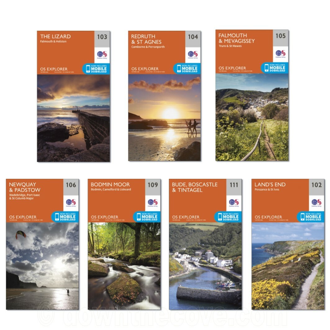


Lizard, Falmouth and Helston by Ordnance Survey (Sheet map, 2015)

Down the Cove (9344)
100% di feedback positivi
Prezzo:
GBP 14,58
CircaEUR 17,02
+ 18,30 di spese di spedizione
Restituzioni:
Restituzioni entro 30 giorni. Le spese di spedizione del reso sono a carico dell'acquirente..
Condizione:
Seleziona un valore per il campo Area
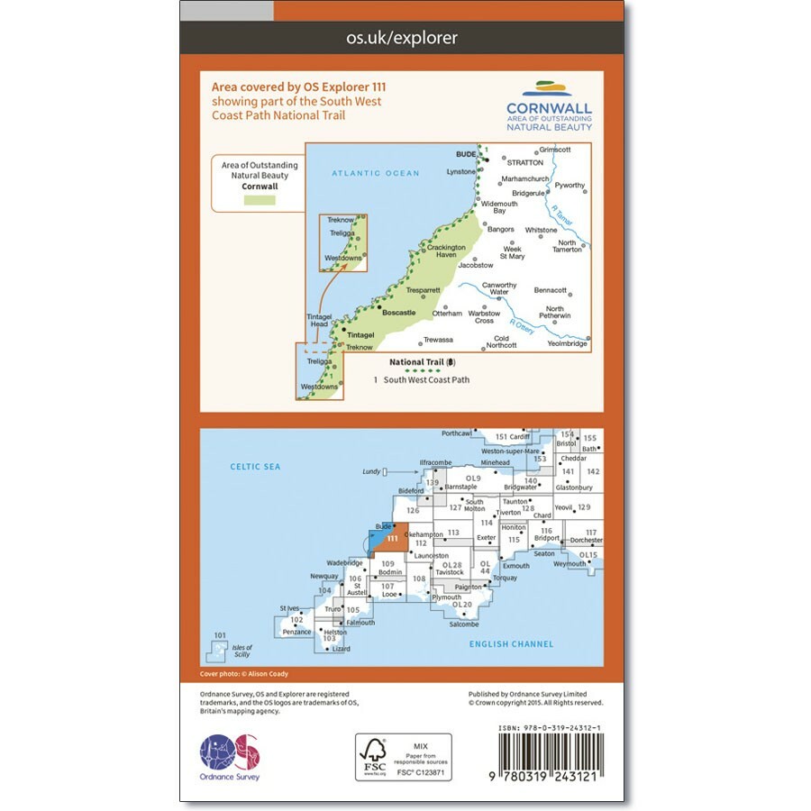
Ordnance Survey Cornwall. 108 - Lower Tamar Valley & Plymouth This map covers the south coast area between Devon and Cornwall area around Plymouth. With a section of Dartmoor National Park along with the Areas of Outstanding Natural Beauty of Cornwall, South Devon and the Tamar Valley, this is an area with lots to discover.
- Compralo SubitoMappa della Cornovaglia Ordnance Survey OS Explorer con download mobile - POST TRACCIATO!
Oops! Looks like we're having trouble connecting to our server.
Refresh your browser window to try again.
Informazioni su questo prodotto
Product Information
OS Explorer is the Ordnance Survey's most detailed map and is recommended for anyone enjoying outdoor activities like walking, horse riding and off-road cycling. The OS Explorer range now includes a digital version of the paper map, accessed through the OS smartphone app, OS Maps. Providing complete GB coverage the series details essential information such as youth hostels, pubs and visitor information as well as rights of way, permissive paths and bridleways.Product Identifiers
PublisherOrdnance Survey
ISBN-139780319243053
eBay Product ID (ePID)214532681
Product Key Features
SubjectTransportation, Sports
Publication Year2015
Publication NameLizard, Falmouth and Helston
LanguageEnglish
Map Scale1:25,000
TypeTravel Maps
AuthorOrdnance Survey
FormatSheet Map
Dimensions
Volume103
Additional Product Features
Country/Region of ManufactureUnited Kingdom
Title_AuthorOrdnance Survey
Series TitleOs Explorer Map


